Weather advisories issued by National Weather Service
Published 6:55 pm Wednesday, January 23, 2019
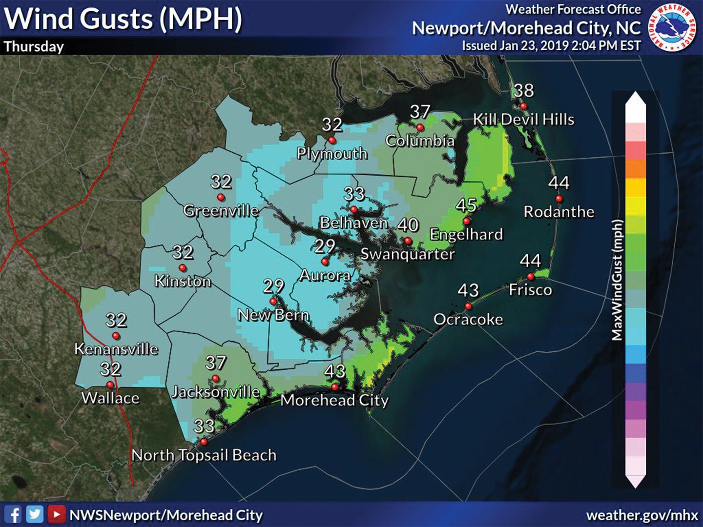
The National Weather Service is advising strong winds and coastal flooding will visit the Outer Banks tonight and Thursday, Jan. 24.
Three advisories have been posted.
Wind Advisory: midnight to 4 p.m. Thursday, Jan. 24.
High Surf Advisory: 5 a.m. until after midnight Thursday.
Coastal Flood Advisory: 8 a.m. to 5 p.m. Thursday.
Wind gusts of up to 45 miles per hour are possible.
Winds are currently blowing south or south southeast. Winds are predicted to peak from the south around noon Thursday. The wind will gradually diminish. The current prediction is, around 4 p.m. Thursday, the wind will be out of the west and then shift gradually northwest.
Strong winds lead to high surf conditions from Cape Hatteras south Thursday. Surf height of 8 to 12 feet is expected. Large and dangerous waves will persist until after midnight Thursday.
The weather service is also advising the strong winds will lead to higher water levels on the northern part of the Pamlico Sound. Up to a foot to a foot and a half above ground is possible Thursday. A map shows soundside flooding north of Oregon Inlet. An earlier forecast pointed out the flooding may occur from Rodanthe north.
Tonight through Thursday, Hatteras and Ocracoke islands may receive one inch to 1½ inches of rain. North of Oregon Inlet, rainfall is expected to total half-inch to an inch.
FOR MORE NEWS AND EVENTS, CLICK HERE.
More News


-
Polls
 Loading ...
-
-