Severe thunderstorms, high winds and dangerous surf predicted
Published 1:14 pm Friday, April 19, 2019
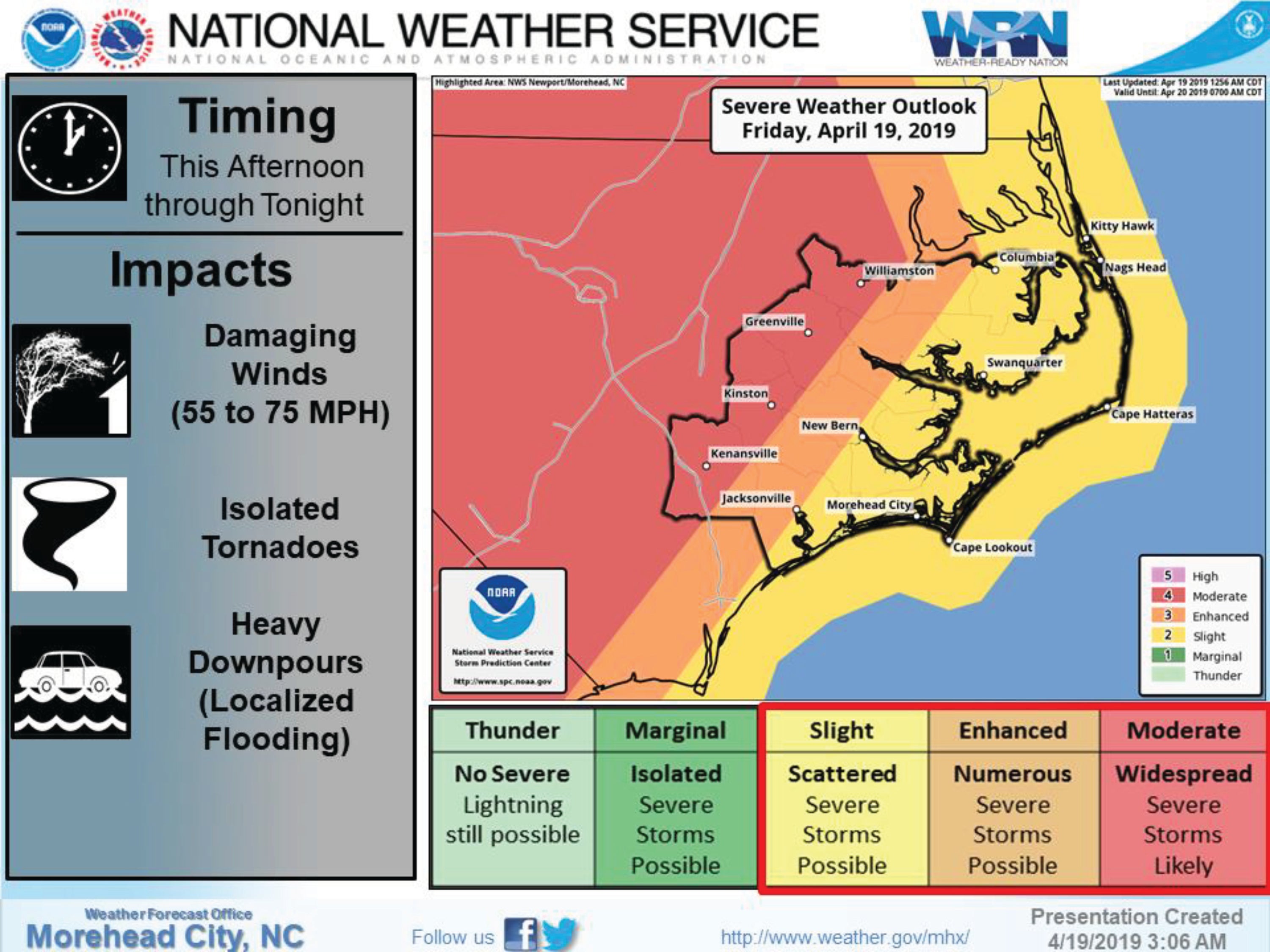
The National Weather Service is expecting widespread severe thunderstorms through Friday night, April 19.
A High Wind Watch has been posted starting at 8 p.m. Friday evening through Saturday morning for Hatteras and Ocracoke islands.
Winds will blow from the south up to 35 to 40 miles per hour with gusts to 60. If a severe thunderstorm crosses an area, wind speeds could blow 55 to 75 miles per hour for a brief period of time.
Storm conditions are expected over coastal waters from Oregon Inlet to Cape Lookout.
Seas will peak around 10 feet Saturday morning.
A High Surf Advisory is in place from 1 p.m. Friday afternoon through 9 p.m. Saturday night.
Conditions will be dangerous to life threatening for anyone entering the surf. Beach erosion will be likely with the potential for dune erosion and ocean overwash.
Minor coastal flooding may occur along the soundside north of Oregon Inlet Friday night through early Saturday, reports the National Weather Service.
Up to one and a half inches of rain are expected.
Driving the weather are strong southerly winds and large seas ahead of a powerful cold front that will cross northeastern North Carolina and move out to sea Saturday morning.
READ ABOUT MORE NEWS AND EVENTS HERE.
RECENT HEADLINES:
More News


-
Polls
 Loading ...
-
-