Unsettled weather visits Outer Banks
Published 3:33 pm Thursday, September 17, 2020
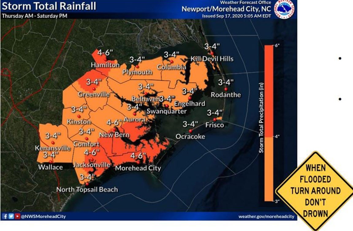
- NOAA image
|
Getting your Trinity Audio player ready...
|
Eastern North Carolina will experience impacts from the remnants of post Tropical Cyclone Sally Thursday and Friday, reports the National Weather Service.
Tropical moisture ahead of the system is expected to bring heavy rain and flash flooding or road ponding. The National Weather Service has posted a flash flood watch through Friday morning. Heavy rain is expected to last through Thursday night and let up some around noon Friday.
Damaging winds gusts and isolated tornadoes are possible from thunderstorms through Friday.
Behind Sally comes stronger, prolonged northeast wind with perhaps more extensive coastal flooding into early next week. Winds are anticipated to blow 30 miles per hour.
Also arriving this weekend are large swells from distant Hurricane Teddy. Once again, very dangerous surf conditions and rip currents will visit Outer Banks beaches. Coastal erosion and dune overwash are possible.
Cape Hatteras National Seashore has also issued a statement on the high astronomical tides forecast for this weekend, posting that travelers on NC-12 and CHNS beaches should be extremely cautious over the next several days. The statement also advised that ocean overwash may occur at the following CHNS locations:
– South of the Basnight Bridge to the Pea Island Visitor Center,
– Mirlo Beach area, on the northern edge of the tri-villages,
– South of the Avon Pier along Ocean View Drive,
– At the north end of Buxton,
– Between Frisco and Hatteras Village,
– Along Pole Rd, south of Ramp 55,
– Along the north end of Ocracoke island.
READ ABOUT MORE NEWS AND EVENTS HERE.
RECENT HEADLINES:
‘Steal’ a masterpiece at The Great Art Heist benefit auction
More News


-
Polls
 Loading ...
-
-