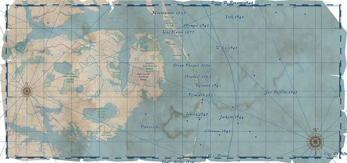
Dare unveils shipwreck map for GIS Day
Published 12:52 pm Wednesday, November 18, 2020
- Courtesy Dare County
|
Getting your Trinity Audio player ready...
|
In celebration of Geographic Information System (GIS) Day on Wednesday, Nov. 18, 2020, the Dare County Department of Information Technologies GIS Division has developed an Outer Banks Shipwrecks Map.
This treasure map-themed web map gives users the opportunity to explore some of the estimated 3,000 shipwrecks in the Graveyard of the Atlantic, which is situated just off the coast of North Carolina. Users can also obtain information about the year each of these vessels sank.
GIS is a scientific framework for gathering, analyzing and visualizing geographic data. Dare County’s GIS Division provides a wide variety of digital mapping resources. Some of the new tools that have been developed this year include a Flood Zone Swipe map as well as the Dare County 150th Anniversary Timeline map.
The Outer Banks Shipwrecks Map that was developed in celebration of GIS Day 2020 can be accessed at gis.darecountync.gov/gisday/2020. Additional mapping resources from the Dare County GIS Division can be found at gis.darecountync.gov/.
READ ABOUT MORE NEWS AND EVENTS HERE.
RECENT HEADLINES:
Boat capsizes in Currituck Sound near Poplar Branch Boating Access
Military flares wash up on Cape Lookout National Seashore beach
More News


-
Polls
 Loading ...
-
-