Dare unveils shipwreck map for GIS Day
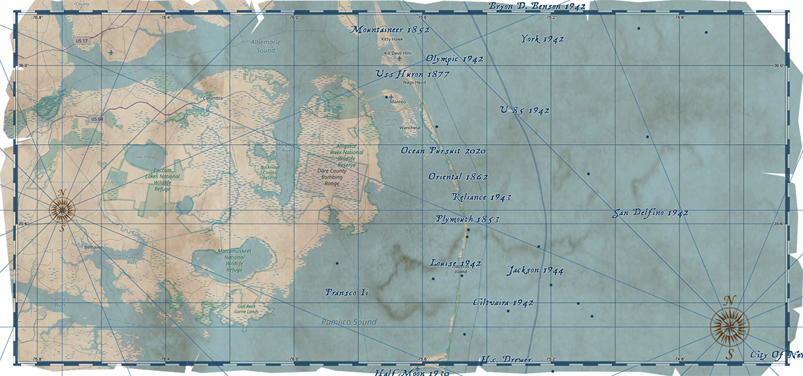
Getting your Trinity Audio player ready… In celebration of Geographic Information System (GIS) Day on Wednesday, Nov. 18, 2020, the Dare County Department of Information Technologies GIS Division has developed an Outer Banks Shipwrecks Map. This treasure map-themed web map gives users the opportunity to explore some of the estimated 3,000 shipwrecks in the Graveyard … Continue reading Dare unveils shipwreck map for GIS Day