New framework in place for beach nourishment on national seashore
Published 8:34 am Saturday, May 29, 2021
- Presents three alternatives for sediment management at Cape Hatteras National Seashore, guiding the special use permitting and partnerships/agreements over the next 20 years.
|
Getting your Trinity Audio player ready...
|
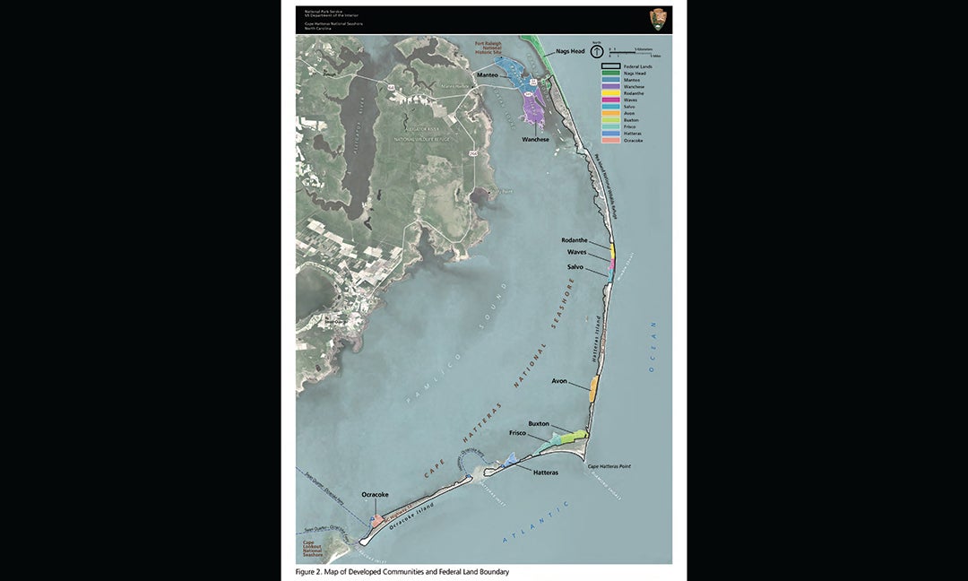
Dare County has two major beach nourishment projects under consideration.
One is to replenish the beach area in Buxton. The second project is to nourish for the first time a beach area in Avon.
Both beach locations are part of the Cape Hatteras National Seashore.
In a major move to help with these and other anticipated projects, the Cape Hatteras National Seashore staff wrote an Environmental Impact Statement and Sediment Management Framework for the national seashore.
On May 12, 2021, the National Park Service South Atlantic-Gulf regional director Stan Austin and U.S. Fish and Wildlife Service Southeast regional director Leopoldo Miranda-Castro signed a Record of Decision for the framework.
David Hallac, superintendent of the seashore and all national park units in eastern North Carolina, told Dare County commissioners on May 17 that all environmental studies are completed for any such projects. The work greatly speeds up National Park Service decision-making on applications for special use permits for four beach actions:
– Beach nourishment projects on the oceanfront and soundside with sand from offshore waters or sand trucked from other locations.
– Habitat restoration at locations like the end of Hatteras Island or Green Island in Oregon Inlet. This action may use thin layer placement.
– Dune nourishment and sand relocation, such as beach grass planting and sand fencing installation by the National Park Service or permittee.
– Emergency breach repairs: When storms create inlets or overwash areas that damage roadways, such a breach “may be addressed by trucking, staging, and pumping sand in from nearby or other locations to fill in the island breach. A breach is a condition where a channel across the island permits the exchange of ocean and sound waters under normal tidal conditions…”
The Record of Decision for the framework stands for 20 years.
The document details the application and approval process for a special use permit for larger scale sediment management projects and lists permit conditions that must be met.
Those conditions are:
– Sediment characteristics (grain size and slope): The grain size, color, texture and geologic characteristics of the sediment from the borrow site must closely match native beach or shore conditions found at the proposed project site. NPS will require that sediment for beach nourishment projects be sourced from outside the active beach profile or the underwater area.
– Volume: Projects must be between about 50-250 cubic yards per foot and range from less than a mile to a maximum of about 6 miles in length annually for oceanfront sites. “Annually, no more than 7.92 million cubic yards can be placed along the ocean side of the Seashore. If an emergency is declared, an additional 6 miles of sediment management (an additional 7.92 million cy) may be considered after completing necessary regulatory permit processes.”
– Borrow areas: Over the last decade, sediment used for projects at the seashore has been dredged from locations in the North Carolina Exclusive Economic Zone (Nags Head 2011; Buxton 2017; Nags Head 2019), which extends from the shoreline to 3 miles offshore. Sediment for future projects may come from these borrow areas or from borrow areas located beyond 3 nautical miles offshore, in federal waters on the Outer Continental Shelf.
– Frequency and extent: Under the conditions established in the document, the National Park Service “will limit the frequency of nourishment projects permitted at a specific site to allow re-establishment of intertidal and nearshore benthic communities following sediment placement.” The NPS may permit sediment management on up to 6 miles of the seashore annually, recurring at individual sites as frequently as every three years. A nourished area will not be eligible to receive sediment within the three years unless permitted under an emergency declaration.
– Time of year: The conditions listing states “The NPS will recommend that proposed projects at the Seashore occur between November 16 and April 1 to avoid breeding and migration periods for listed shorebird species and nesting seasons for sea turtles. However, where safety conditions or other logistical considerations may preclude winter-time activities (e.g., emergency response, projects that require open-ocean dredging), the Seashore may permit summertime work.” Conditions for summertime work are extensively listed Appendix B of the Record of Decision.
– Ongoing scientific review: “Every two years, the Seashore and the Refuge will convene agency regulatory partners, i.e. US Army Corp of Engineers, US Fish and Wildlife Service, NC Department of Environmental Quality, NC Wildlife Resources Commission, National Marine Fisheries Service to review the results of monitoring, emerging scientific information, new regulatory requirements, and new erosion and transportation management solutions (such as proposed bridge building).”
– Mandatory mitigation measures are listed and regulatory agencies may require additional conditions.
The framework lists several non-contiguous miles of beach were beach nourishment will not be permitted. The areas represent about 13 miles of the seashore’s beach. The areas are called reference zones which will be used to perform comparative ecological monitoring studies with nourishment project areas.
The areas are:
– Pea Island National Wildlife Refuge: About 2 miles from the start of the Jug Handle Bridge to the boundary of Mirlo Beach/Rodanthe Village. Coordination with the US Fish and Wildlife Service is required.
– Between Salvo and Avon: 2 miles from Village of Salvo to 1 mile south of Ramp 25.
– Cape Hatteras Point to Frisco: 5 miles from the point to an area west of Ramp 49.
– Hatteras Island terminus: Approximately 1 mile from Ramp 55 toward the terminus (excluding the end of the island for habitat restoration projects).
– Ocracoke Island terminus: 2 miles from Ramp 72 to the intersection with Ocracoke Inlet
Numerous agencies worked on this document. The National Park Service extended thanks to
U.S. Army Corps of Engineers Wilmington District Regulatory and Planning divisions; U.S. Fish and Wildlife Service Pea Island National Wildlife Refuge and Raleigh Ecological Services Field Office; the Bureau of Ocean Energy Management; the North Carolina Department of Transportation Ferry and Highway divisions; the North Carolina Wildlife Resources Commission; Dare County and Hyde County.
To view the Record of Decision, Environmental Impact Statement and associated documents, visit parkplanning.nps.com/CAHAsediment.
READ ABOUT MORE NEWS AND EVENTS HERE.
RECENT HEADLINES:
Going down: Tugboat Valley Forge sunk as part of artificial reef project
More News


-
Polls
 Loading ...
-
-