Complex weather system hits Outer Banks
Published 10:29 pm Tuesday, January 4, 2022
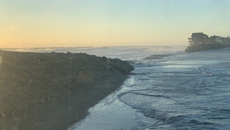
- The area of NC 12 in Mirlo Beach area just north of Rodanthe Tuesday morning, January 4. Courtesy NCDOT
|
Getting your Trinity Audio player ready...
|
The National Weather Service warned the Outer Banks about the approaching storm, the first of 2022. The weather service called the unsettling storm, “a complex low pressure system.”
Initially, the storm impacts were to hit the Outer Banks on Sunday. The arrival was delayed.
The weather service placed three advisories on the Outer Banks.
A wind advisory was eventually replaced with a high wind warning for Monday, Jan. 3. Southwest wind drove Pamlico Sound water northward.
The wind changed around noon on Monday, first to the west then to the northwest or north northwest. That wind change sent Pamlico Sound water into Hatteras, Frisco and Avon villages and onto NC 12.
A coastal flood advisory was posted for Monday morning continuing through mid-morning Tuesday. Both ocean and sound sides of Hatteras Island were affected with coastal flooding.
By 4:30 p.m. on Monday, Dare County Sheriff’s Office deputies working on Hatteras Island reported the following NC 12 road conditions: just north of Avon, two inches of water on the roadway; four to five inches of water near Conner’s in Buxton; 8 to 10 inches of water near the Frisco pier; six to eight inches for most of Hatteras village with the exception of the area near the Hatterasman, where water was up to 12 inches.
The weather service also had a high surf advisory in place. The service estimated that waves up to 12 feet would hit the beaches.
At Tuesday morning’s high tide cycle, the high surf ocean water started covering NC 12. At 7:30 a.m., NC 12 was closed from Rodanthe to Oregon Inlet. A breach north of Rodanthe opened up. Once the high tide cycle relaxed, NCDOT crews went to work pushing sand to create a dune line. The road opened at 1:45 p.m.
At the north end of Buxton, NC 12 was closed mid-morning as ocean water gushed across NC 12. Three vehicles were stuck in the roadway.
The National Weather Service posted highest winds recorded on Jan. 3 for the following locations: Oregon Inlet 86 mph; Jennette’s Pier 81 mph; Roanoke Sound Channel 70 mph; Avon 66 mph; Duck pier 63 mph; Rodanthe 57 mph; Nags Head 55 mph; Southern Shores 46 mph; Manteo 31 mph.
On Monday, 530 Dominion Power customers from Corolla to Roanoke Island lost power due to the storm. Most of the power outages were in the Airport Road area on Roanoke Island. All storm-related outages have been restored, reports Dominion Power.
During the storm, falling pine trees and limbs broke wires, poles and cross arms along Airport Road.
Dare County’s Emergency Operations Center was without Dominion Power from 9:44 a.m. to 7:45 p.m. The center was powered by a back-up generator. The Dare County Airport and North Carolina Aquarium also lost power. Crews were still working in the area on Tuesday afternoon.
The Cape Hatteras Electric Cooperative did not lose a circuit during the storm.

More News


-
Polls
 Loading ...
-
-