North Carolina remapping trial begins with case on a fast track
Published 7:14 am Tuesday, January 4, 2022
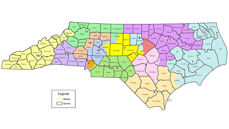
- Courtesy North Carolina General Assembly
|
Getting your Trinity Audio player ready...
|
By Gary D. Robertson, Associated Press
A fast-moving redistricting trial began Monday, designed to determine whether North Carolina’s new congressional and legislative maps contain unlawful gerrymanders that must be redrawn or otherwise can be used in this year’s elections.
Three state trial judges started hearing evidence offered by lawyers for plaintiffs in lawsuits that allege district boundaries approved by the Republican-controlled legislature in November are tainted by extreme partisanship and racial bias that make GOP majorities almost unbreakable. Republicans say the lines are lawful, crafted using a transparent process that avoided racial and partisan data.
Outside groups analyzing the lines project GOP candidates would be favored to win at least 10 of the 14 U.S. House seats next fall, and to preserve or expand current Republican majorities in the state House and Senate, even as North Carolina’s statewide elections are usually closely divided.
North Carolina gained an additional House seat based on population growth in the 2020 census. Republicans currently hold eight of the state’s 13 congressional seats, so the state’s GOP remap could help the party take back the U.S. House.
This case is on a fast track, with no opening statements and just three days to present evidence to the three judges. Closing arguments are Thursday.
The quick timetable is the result of the state Supreme Court, which last month ordered the judges to hear redistricting litigation and rule by Jan. 11 — after which appeals are expected. The justices delayed last month the March 8 primary until May 17 in the meantime.
The three Superior Court judges — Graham Shirley, Nathaniel Poovey and Dawn Layton — initially refused last month to issue preliminary injunctions against the boundaries, declaring there was reasonable doubt whether the lines violated the state constitution. But the justices told them to look again.
In 2019, a different three-judge panel declared there was evidence that GOP legislators created extreme partisan gerrymanders when drawing U.S. House districts in 2016 and legislative districts in 2017. The legislature redrew the maps in time for the 2020 elections.
One of the lawsuits heard Monday was filed by the North Carolina League of Conservation Voters, mathematicians and voters, with the other filed by voters supported by a group affiliated with the National Democratic Redistricting Committee.
University of Michigan political science researcher Jowei Chen, a key witness for the Democratic plaintiffs, compared the newly enacted U.S. House map with computer-generated boundary lines that follow population changes and rules approved by legislators.
Out of 1,000 computer-generated congressional plans, Chen testified, no more than 3% of them generated proposals where Republicans were projected to win 10 seats based on recent statewide election outcomes. And the districts created by Republicans protect GOP candidates so much it’s almost impossible for Democrats to win more than four seats in a good year for their party, Chen’s data indicates.
The plan “is a statistical outlier in its partisanship and that it creates a level of Republican bias that cannot be explained by North Carolina’s political geography or by the General Assembly’s … adopted criteria,” Chen told plaintiffs’ lawyer Lali Madduri.
On cross-examination, Patrick Lewis, a lawyer for Republican legislators, sought to dampen beliefs that lawmakers produced an extreme map. He pointed out Chen’s analysis found the most common outcome still gave Republicans a good chance to win nine of the 14 seats. And very few results would give Democrats a solid opportunity to win seven of the seats — a result that many in the party consider a fair outcome.
Another plaintiffs’ expert who testified, Duke University mathematics professor Jonathan Mattingly, said he and his academic team helped generate 100,000 nonpartisan maps each for the state House and Senate.
The political outcomes generated by legislative and congressional boundaries show “a systematic pro-Republican bias” that would preserve GOP majorities in those chambers, Mattingly said.
A landmark redistricting ruling by the state Supreme Court in the early 2000s found the General Assembly “may consider partisan advantage” in drawing districts.
On the eve of the trial, Senate leader Phil Berger said he remained confident that the maps drawn by Republicans were “within the law and highly constitutional.”
“I do continue to believe the maps that we drew were drawn consistent with the rules that we had set up in the Senate, that those maps should be approved by the courts,” Berger told reporters late last week.

More News


-
Polls
 Loading ...
-
-