Workshops scheduled for county’s Land Use Plan update
Published 12:23 pm Wednesday, April 11, 2018
The Dare County Planning Board and staff will conduct a series of workshops to kick-off the update process of the Dare County Land Use Plan.
The workshops are scheduled for 5 p.m. as follows:
–Monday, April 23, Dare County Administration Building, Manteo
–Tuesday, April 24, Fessenden Center, Buxton
–Wednesday, April 25, Thomas A. Baum Center, Kill Devil Hills
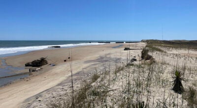
The purpose of the workshops is to solicit public input from citizens and property owners on the vision statement and policies of the Dare County Land Use Plan. As one of the twenty coastal counties, Dare County is required by the State of North Carolina to adopt a comprehensive land use plan and update the plan every five to ten years. The current land use plan was certified by the State of North Carolina in 2011.
Interested parties are invited to attend any of the workshops to interact with the Planning Board and Planning Department staff in an informal setting to provide input on land use issues that will be addressed in the plan. The format of the workshops will be the same each evening so citizens may attend the location most convenient for them.
For additional information, contact Dare County Planning Director Donna Creef at (252) 475-5873.
This Land Use Plan is applicable to unincorporated Dare County. These workshops are the first of several opportunities that Dare County citizens will have to participate in this planning effort. The public participation plan was approved by Dare’s Board of Commissioners, April 3.
The current vision statement is as follows: “Manage the growth and development in a manner that preserves the historical, cultural, and natural resources that make Dare County a desirable place to live, work, and visit. Unincorporated Dare County should retain the characteristics typical of the entire County before the incorporated municipalities experienced urban-style growth. It is the goal of Dare County to shape the growth of the unincorporated villages in such a manner that they retain their historical character.”
Topics and policies currently addressed in the existing Land Use Plan are:
Public Access: Shoreline Access, ORV Access, Bonner Bridge, Working Waterfronts, Shoreline Management, Wildlife Resources
Land Use Compatibility: Coastal Heritage, Residential Development, Commercial Development, Re-development, Industrial Development, Manmade Hazards, Land Disturbance, Archaeological/Historical Resources, Public Acquisitions, Maritime Forest, Forestry/Agricultural Infrastructure/Carrying Capacity: Wastewater, Water, Transportation, Solid Waste, Energy Facilities
Natural Hazards: Ocean Shoreline, Estuarine Shoreline, Flood Hazards, Storm Mitigation, Climate Conditions
Water Quality: Water Quality, Stormwater, Wetlands, Fisheries Resources, Marinas
Local Areas of Concern: ORV Access, Federal/State Support, Tourism, Public Participation, Channel Maintenance/Oregon Inlet, Buxton Coast Guard Base, Insurance.
The current Land Use Plan is available online at darenc.com under Planning Department.
(Note: Information about the vision and policies of the current Land Use Plan was added by The Coastland Times staff.)
More News


SportsPlus
Best Bets, Predictions & Odds for the Old Dominion vs. Georgia Southern Game – Thursday, Oct. 24
Sun Belt opponents will clash when the Old Dominion Monarchs (3-4) battle the Georgia Southern Eagles (5-2). Below,…
Old Dominion vs. Georgia Southern: Odds, spread, and over/under – Oct. 24
Sun Belt play pits the Old Dominion Monarchs (3-4) against the Georgia Southern Eagles (5-2) on Thursday, October…
Where to Watch Philadelphia Flyers vs. Washington Capitals on TV or Streaming Live – October 22
NHL action on Tuesday includes the Philadelphia Flyers (1-3-1) hosting the Washington Capitals (3-1) at Wells Fargo Center,…
Sun Belt Football Predictions, Computer Picks & Best Bets | Week 9
If you are looking for information on the best bets in Sun Belt action in Week 9, or…
Flyers vs. Capitals Injury Report Today – October 22
Ahead of their Tuesday, October 22 matchup with the Washington Capitals (3-1) at Wells Fargo Center, which starts…
-
Polls
 Loading ...
-
-