Underlying science shows reasons for NC 12 trouble
Published 10:54 am Thursday, July 29, 2021
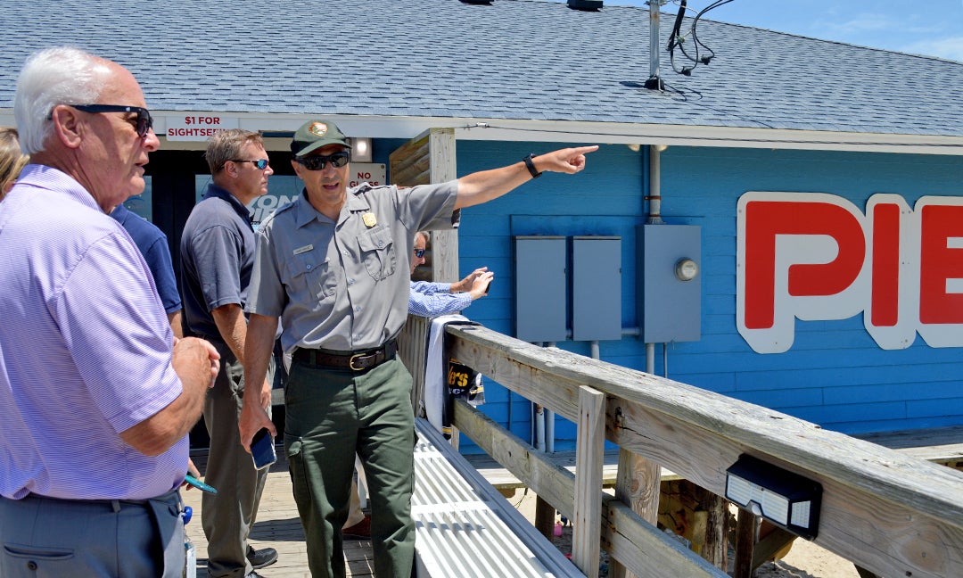
- Dave Hallac, superintendent of National Parks of Eastern North Carolina, points southward from the Avon Pier and talks to Robert L. Woodard, chairman of the Dare County Board of Commissioners. Dare County is sponsoring a beach nourishment project from north of the Avon Pier to the southern boundary of Avon. Recently, easement documents have been mailed to all oceanfront property owners along the project area. The nourishment project purpose is to protect NC 12 through that portion of Avon. Mary Helen Goodloe-Murphy photo
|
Getting your Trinity Audio player ready...
|
Somber science started a meeting of the NC 12 Task Force subcommittee.
The task force is charged with collaboratively developing a long-term, prioritized plan for the transportation corridor including identifying hot spots and challenges related to erosion, storms and sea level rise, recommending solutions and finding funding.
A scientific trio presented the physical science underlying the task force work.
The presentation, titled “Impacts of erosion, sea level rise, and the potential for breaches at N.C. Highway 12 hot spots,” was prepared by D. Reide Corbett with the Coastal Studies Institute, East Carolina University; Michael Flynn with North Carolina Coastal Federation; and David E. Hallac, Cape Hatteras National Seashore, National Parks of Eastern North Carolina.
Hallac led off, stating that the national seashore was a “highly altered system.” Between 1936 and 1940, 600 miles of sand fencing was installed. Transportation issues are not new. In 1962, Buxton Inlet was formed.
Corbett said “we are not unique.” Barrier islands make up 10% of the global ocean shoreline.
Changes come from storms, sediment supply, inlet dynamics and sea-level changes. Corbett displayed a graphic showing the familiar barrier island evolution, with long-term landward island migration and preservation.
As an example, Corbett said compare the breach at the Etheridge bridge in Pea Island National Wildlife Refuge with the breach at Izzy Inlet, filled and protected by a dune line. At the Etheridge Bridge, sand is filling the area on the western side of the bridge. At Izzy Inlet, the island is narrowing.
Urging consideration of sediment sources other than longshore transport, Corbett pointed to nearshore morphological ridges. These ridges, “shore oblique bars likely play an important role in shoreline change dynamics spatially and temporally,” explains a slide. The ridges are named Platt, Wimble, Kinnakeet and Diamond Shoals.
Corbett said “Wimble Shoals is moving south.” He estimated about three feet in a dozen years.
A series of slides showed the position of the shoreline in 20 to 30 years. At Izzy Inlet the shoreline will be to the west of the highway; in Rodanthe, the shoreline will also be past the road.
In a chart showing the linear regression rates from 1998 to 2019, the highest regression rate was found at the hot spots in Pea Island National Wildlife Refuge at 4.8 and Avon at 4.9 meters. Buxton had the lowest at 1.1 meters.
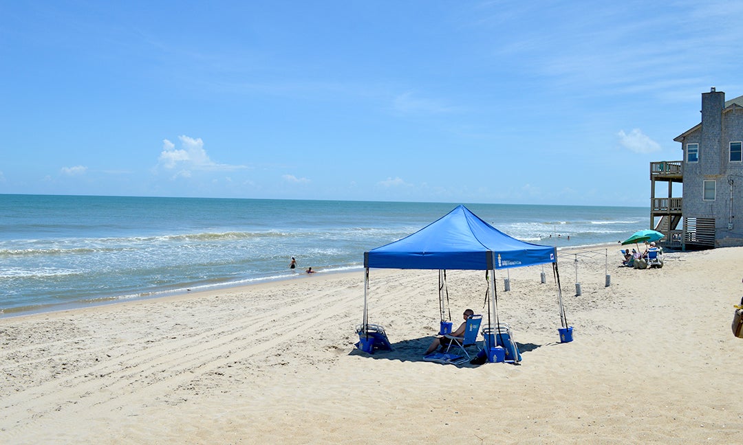
Rodanthe oceanside beach looking south. Mary Helen Goodloe-Murphy photo
Moving on to sea level rise, the presentation states “challenges associated with erosion are likely to become more significant and complex with SLR [Sea Level Rise].”
NOAA has a tidal gauge at Oregon Inlet Fishing Center, which measures water levels. The presentation on monthly sea level data from 1977 to 2020 shows a rise of 5.32 millimeters per year, “which is the equivalent of 1.75 feet in 100 years.”
NOAA’s Sea Level Rise Viewer was used to demonstrate potential sea level rise inundation at with 1, 2, and 3 feet of sea level rise at each hotspot.
For planning purposes, NOAA’s predictions show between a quarter meter to 1.1 meters, or up to a possible 2.46 feet at a rise of 0.75 meters.
Said Corbett, “plan for elevation not by tide.” For planning purposes “it’s tough… You have to plan for ranges.”
Beyond the underlying geology, storms like hurricanes and northeasters bring change. “Most frequent storms are nor’easters,” at 30-35 per year.
The presentation ended with “ideas for prioritization,” reflecting the science: erosion rates, sea level rise impacts, distance from shoreline and transportation volume.
At the end of the presentation, Robert L. Woodard, who chairs the Task Force and the Dare County Board of Commissioners, turned to two visitors, Betty Jo Shepheard representing U.S. Senator Richard Burr and Trey Lewis with U.S. Senator Thom Tillis.
“We’re going to need your help,” said Woodard.
The meeting and subsequent tour of Hatteras Island Hot Spots was held July 13, 2021.

RECENT HEADLINES:
Nags Head Ocean Rescue places third overall, second in division at lifesaving competition
More News


SportsPlus
Week 4 Anytime Touchdown Scorers: Best Bets and Odds
If you’re searching for Week 4 anytime TD prop bets, you’ve come to the right place. There are…
Best Bets, Predictions & Odds for the Old Dominion vs. Bowling Green Game – Saturday, Sept. 28
It’ll be the Bowling Green Falcons (1-2) versus the Old Dominion Monarchs (0-3) in college football play at…
MLB Betting Lines and Picks Today | Sept. 26
The San Diego Padres and the Los Angeles Dodgers square off for one of many exciting matchups on…
NFL Week 4 TV Schedule, Streams, Start Times, Channels
The NFL schedule in Week 4 is sure to please. The outings include the Tennessee Titans taking on…
Old Dominion vs. Bowling Green: Odds, spread, and over/under – Sept. 28
The Old Dominion Monarchs (0-3) will look to upset the Bowling Green Falcons (1-2) on Saturday, September 28,…
-
Polls
 Loading ...
-
-