Nags Head Planning Board approves flood maps, revisits ADUs
Published 8:56 am Thursday, April 9, 2020
|
Getting your Trinity Audio player ready...
|
The Nags Head Planning Board held a virtual meeting via the Zoom platform on April 1. One main item pertaining to the flood prevention ordinance was on the agenda for discussion. All members were present for this meeting.
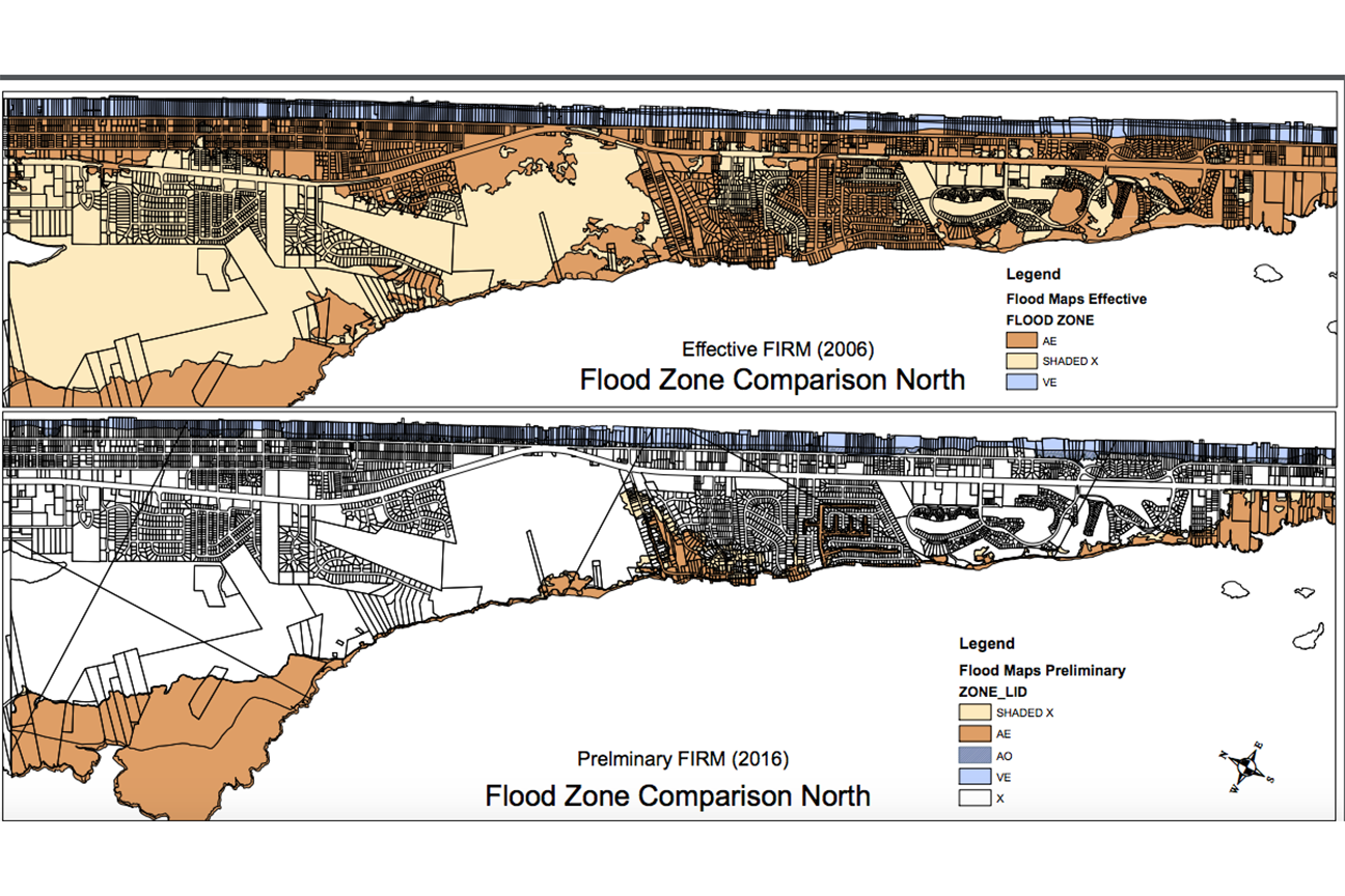
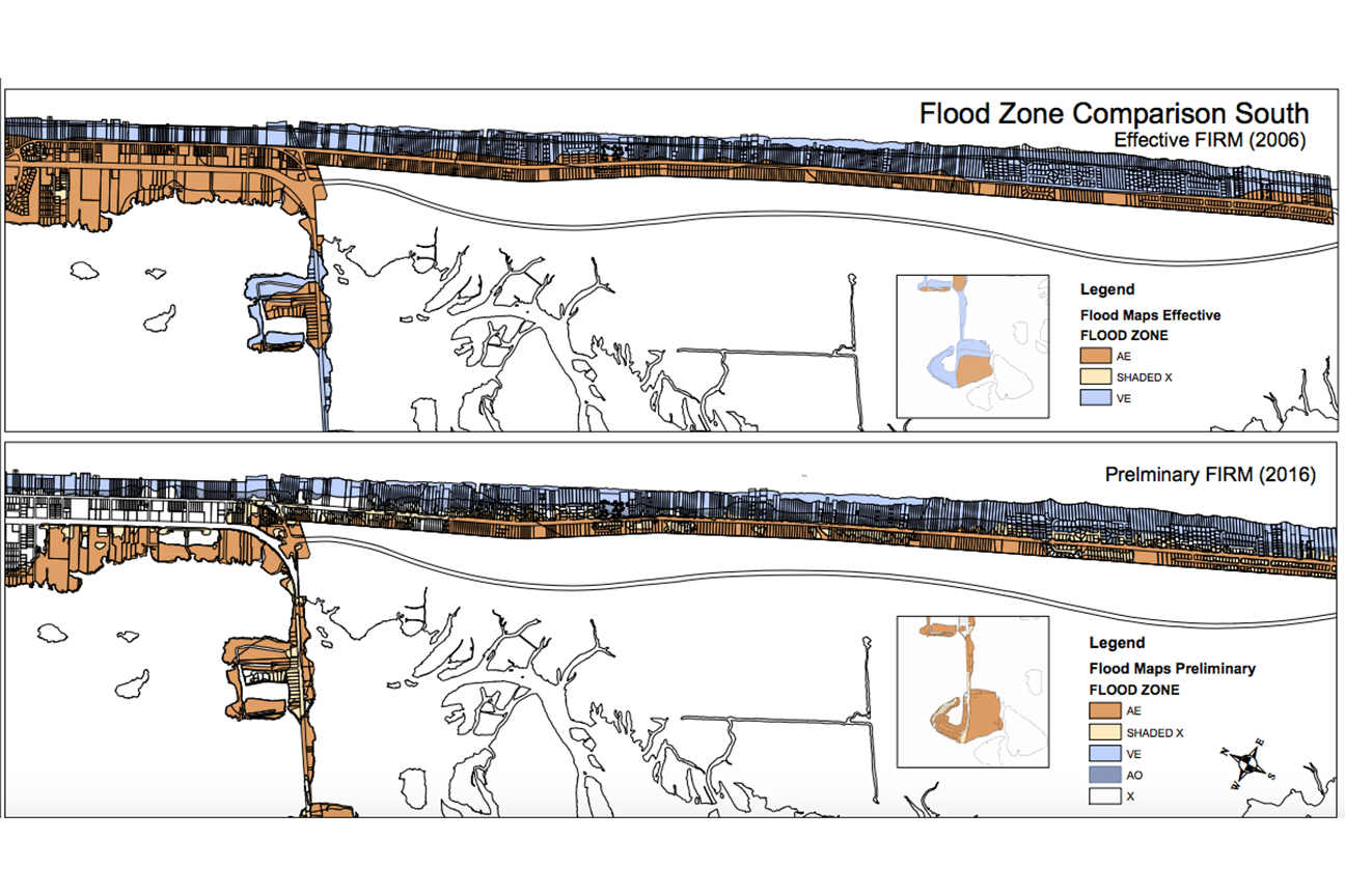
Once board members were accounted for and the consent agenda was approved, director of planning and development Michael Zehner and principal planner Holly White highlighted the proposed flood maps for Nags Head.
White emphasized that staff has stressed for residents to maintain their flood insurance despite the changes made to the maps.
Major changes to the flood maps for Nags Head include an increase in X-zone properties town-wide, as well as a reduction in V-zone properties along the oceanfront and fewer AE properties west of NC Hwy. 12.
White said in an effort to protect future development from flooding, Nags Head staff has revised local elevation standards (LES) for certain areas.
Areas east of NC Hwy. 12/SR 1243, otherwise known as the oceanfront area, will have a 12 ft. LES requirement and will comply with VE zone construction requirements. Areas west of NC Hwy. 12/SR 1243, which includes the causeway, will have a 10 ft. LES and be treated as AE properties. Enclosures in these AE properties will be limited to 300 sq. ft. or less.
“By implementing this, we are essentially treating properties as they are treated today,” White noted.
For shaded X and X-zones, White said the town will not apply the definition of substantial improvement/damage. Lateral additions to shaded X and X-zone properties west of NC Hwy. 12/SR 1234 properties can be expanded by 25% if they are at the same level and below regulatory base flood protection elevation without having to be elevated to or above the regulatory flood protection elevation.
“If you went beyond 25% of the floor area, then you would have to elevate that addition to RFPE,” White said.
After summarizing the changes to the updated flood map, the board members agreed to adopt the proposed ordinance with noted revisions from state NFIP coordinator and the motion carried unanimously.
Following the approval of the flood prevention ordinance, board member David Elder asked to revisit the topic of additional dwelling units (ADUs).
Elder mentioned the new emphasis on ADUs in terms of employment housing issues that are “ongoing and difficult to deal with.”
“We have a residual level of structures that are being utilized as Airbnbs and since they have become a bit of a glut on the market, there is an amount of interest to move that into longer term rentals [or] seasonal rentals for workers,” Elder added.
He presented the matter as an opportunity to revisit ADUs in combination with workforce housing accommodations. Board member Megan Lambert agreed, adding that perhaps the board could propose the idea of ADUs with a deeded restriction for consideration to the Board of Commissioners.
Zehner said there may be an “opportunity to continue to look at things from the affordability and workforce housing side,” when it came to ADUs. He agreed to add it a future agenda and note the topic in his report for the commissioners at the upcoming April 15 meeting.
RECENT HEADLINES:


