Watch for dangerous rip currents
Published 9:30 am Saturday, May 16, 2020
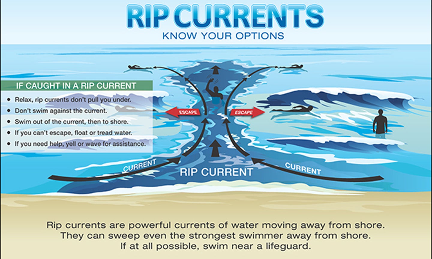
- NOAA image
|
Getting your Trinity Audio player ready...
|
The National Weather Service is tracking a low pressure system currently hovering over the Straits of Florida.
The National Hurricane Center, in a Special Tropical Weather Outlook, reports that “gradual development of this system is expected, and it will likely become a tropical or subtropical storm on Saturday when it is located near the northwestern Bahamas.
“Later in the weekend and early next week, the system is expected to move generally northeastward over the western Atlantic.”
The National Weather Service out of Morehead City writes “regardless of whether or not this system gets a name, it is expected to bring an increased threat for life-threatening rip currents to eastern North Carolina beaches” through early next week.
On Saturday morning, a moderate rip current risk south of Cape Hatteras has been reported. This includes Frisco, Hatteras Village and Ocracoke. The advisory stated that only experienced surf swimmers who know how to escape a rip current should enter the water. Additionally, it is advised to never swim alone and always take a floatation device.
“Increased swell will produce stronger and more frequent rip currents. Swimming will be very dangerous, states the National Weather Service for eastern North Carolina.
READ ABOUT MORE NEWS AND EVENTS HERE.
RECENT HEADLINES:
Outer Banks open to visitors; COVID-19 restrictions still in place
Large dwellings main topic of discussion at Kill Devil Hills meeting
More News


SportsPlus
How to Watch MLB Baseball on Friday, July 26: TV Channel, Live Streaming, Start Times
The Cleveland Guardians versus the Philadelphia Phillies is one of many compelling options on today’s MLB schedule. Wager…
How to Watch the Orioles vs. Padres Game: Streaming & TV Channel Info for July 26
Gunnar Henderson and the Baltimore Orioles will meet Jurickson Profar and the San Diego Padres on Friday at…
Orioles vs. Padres: Betting Preview for July 26
The Baltimore Orioles (61-41) and the San Diego Padres (55-50) will clash in the series opener on Friday,…
Carolina Panthers vs. Tampa Bay Buccaneers Week 13 Tickets Available – Sunday, December 1 at Bank of America Stadium
An NFC South battle between the Carolina Panthers (0-0) and Tampa Bay Buccaneers (0-0) is scheduled for Sunday,…
Carolina Panthers vs. Arizona Cardinals Week 16 Tickets Available – Sunday, December 22 at Bank of America Stadium
Sunday, December 22, 2024 will see the Carolina Panthers (0-0) go on the road to match up against…
-
Polls
 Loading ...
-
-